loading map - please wait...
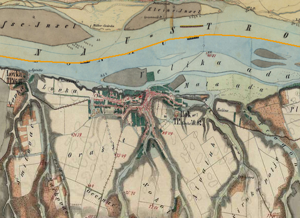
Auxiliary fort: Ilok – Cuccium
The Roman fort was located on the present-day site of Gornji Grad and has an extremely good strategic position. The remains of clay water pipes provide evidence of the Roman water supply system that went from the spring Dekan, across Vodena Glava to what is today Gornji Grad. Many chance finds of Roman architecture, sarcophagi, small objects and coins were found at the site.
The auxiliary fort was probably constructed at the end of the 1st or the beginning of the 2nd century AD.
Military units:
cuneus equitum Promotorum Cuccis, Equites Sagittarii Cuccis.
Literary sources:
It. Ant. 243,2, Tab. Peut. VI 3, Not. Dign. occ. 32,6,13; 32, 15; 32, 32, Geogr. Rav. IV 20,
Archaeological monuments:
Votive monuments: CIL III 3264 = HD074699; CIL III 15138 = HD074698
Literature:
 Hrvatski
 English